Detecting Marine Plastic from Space!
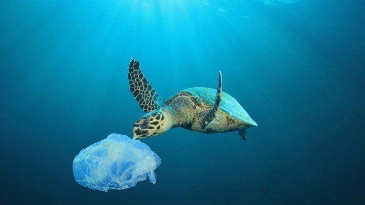
Ocean litter has been a major problem for the environment for many years now. Tons of plastic seem to end up in the seas (12.7 million tons annually), immediately affecting the function of marine life and the ecosystem. Many marine species, such as whales, fish, turtles and even seabirds ingest the plastic waste, mistaking it for food or prey. They therefore die of suffocation or starvation, since the plastics get stuck in their throats, or their stomachs become full of indigestible waste. Some animals may also get entangled in plastic litter - such as plastic bags - disturbing their quality of life and putting their survival in danger. These are only the most visible impacts of ocean plastic, with the less obvious but radical outcomes being the melting of ice and global warming.
Many initiatives have been programmed from the scientific community, global organizations and space agencies, who have been working on developing technologies capable of monitoring, detecting and clearing the oceans. This mission can be extremely challenging, since small amounts or pieces of plastic waste cannot be detected from space. However, bigger proportions will be easier to monitor, keeping in mind that floating debris tends to aggregate.
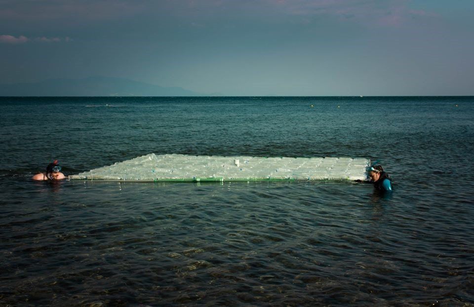
For this purpose, an experiment called the Plastic Litter Project took place in Mytilene of Lesvos Island in Greece, by the University of the Aegean and its Marine Remote Sensing Group. The project aims were to create an algorithm which will allow the observation and recording of certain masses of plastic pollution (at least at the ocean surface), by using aerial monitoring. This was done with the help of drones and combined with satellite data from the Sentinel-2 satellite, operated by the European Space Agency (ESA). The Sentinel-2’s purpose is to create a continuously evolving map of Earth’s land, but in the process, it is able to capture the view of coastal areas as well. It passes periodically from the study area, with a spatial analysis of 10m, which means it can detect masses of the order of 10m. Knowing this, the MRSG created targets from PET-1 1.5 L plastic bottles, LDPE plastic bags and nylon fishing ghost nets, attached to a 20 inch PVC pipe frame. These were placed in the water, far from each other, just before the satellite passed above.
The experiment took place in 2018 and 2019. The first year, the targets were three squares of 10m x 10m width and the results were very positive. An important finding was that, in order to find those plastics, the coverage they have on the pixel should be at least of the order of 50%. The next year in 2019, the targets became four and got minimized to ¼ of their original size, meaning they were 25m² each. Apart from plastics, organic material such as branches and leaves were used in order to make the targets more realistic, since the floating debris does not only consist of plastic or one single material. It is important to mention that the Sentinel satellites have very good quality detecting instruments, meaning that their clarity in the way they sense different wavelengths is significant. This can be used in order to interrogate each pixel of an image to sort out what kind of material they are more likely to contain, even if they cannot be directly resolved. Vegetation and plastic have very different signatures. The plastic litter is, thus, more detectable this way. This allows us to identify which materials can be detected and which ones cannot.
Such an experiment will in the long term make it possible for scientists to locate areas where there is a collision of plastics - meaning currents which are all moving towards the same direction - which brings the floating plastics closer together, and finally creates a large plastic mass on the water surface. This is a very promising method, as it proves the usefulness of technology in collecting data from remote regions, the creation of maps with a low cost and high spatial analysis, as well as the development of 3D surface models in a real scale for the assessment of the plastic waste sizes and the observation of marine litter from the most favorable point of view. All these will contribute highly to this important issue, and the protection and conservation of the marine environment worldwide.
References:
Topouzelis, K, Papakonstantinou, A., Garaba, S.P., 2019. Detection of floating plastics from satellite and unmanned aerial systems (Plastic Litter Project 2018), International Journal of Applied Earth Observation and Geoinformation, Vol. 79, 175-183
Marine Remote Sensing Group, 2018. Drone Mapping and Satellite Testing for Marine Plastic on Aegean Sea. mrsg.aegean.gr
Pazianou, A., 2019. Litter recording from satellite (in Greek). kathimerini.gr
SHARE THIS ARTICLE
